
Understanding Traveler Behavior

Understanding Traveler Behavior
In the first of two posts, we explore Activity-Based Models (ABM) and traditional trip-based models, focusing on their use in predicting travel patterns. The case study involves the SR 167 Master Plan project in Seattle, Washington, revealing differences in results between ABMs and traditional 4-step models. For nuanced changes, such as introduction of a toll, ABMs may be better suited to capture diverse reactions.
Transportation infrastructure projects, often requiring significant investments, demand thorough analysis and justification. In the planning phase, choosing prediction methods becomes crucial. ABMs, gaining popularity over trip-based models, offer detailed information and deeper insights, aligning with the evolving focus on managing, not just growing, transportation networks.
This post serves as a continuation of our discussion on ABM applications in transportation equity analysis. Using the SR 167 Master Plan project as a case study, we compare outputs from the regional Puget Sound Regional Council trip-based model and the PSRC SoundCast ABM when modeling a tolling scenario.


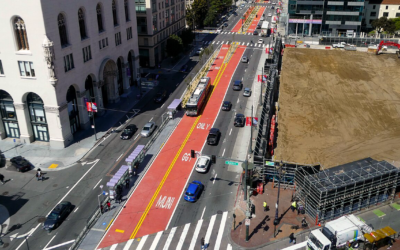
The SR 167 Master Plan aims to improve traffic flow along the corridor during peak hours through transportation investments and new technologies. SR 167 currently features two general-purpose lanes and one Express Toll Lane (ETL) in each direction. One proposed investment, as depicted in Figure 3, was to convert the existing general-purpose lanes into ETLs during peak periods, creating a fully tolled facility.
While this proposal was screened out of the Master Plan for further consideration, it served as a useful scenario to compare model performance on some key metrics – impact to parallel arterials, person throughput, transit ridership, and impact to equity priority areas.

ABMs are generally better for modeling driver responses to tolling, as they more accurately account for the distribution of travelers’ value of time, vital for modeling reactions to the introduction of pricing or changes to existing tolls. Trip-based models are often less nuanced in how they model tolling, as they lack the detailed inputs and processes to account for a person’s value of time. [1] One would assume that this difference in approach could lead to different results when testing the effect of the same scenarios in each model.
And indeed, we found that the trip-based model forecasted a much larger decrease in travel on SR 167 than the ABM predicted, with a much higher portion of trips instead shifted to parallel arterials.

Stepping back – while both models offer insights into future potential corridor operations, accounting for the value of time and money can help professionals and decision makers better use models to analyze, justify, and communicate the benefit of projects to the communities they represent.
Want to learn more? Explore the options below to facilitate informed discussions, make sound infrastructure decisions, and promote equitable transportation solutions.
Stay Informed:
Explore ABMs and the evolving world of transportation modeling in infrastructure decisions.
Reach Out:
Connect with one of this post’s contributors below to discuss the nuances of transportation models.
Stay Updated:
Find recommended transportation strategies and projects for the SR 167 study area on WSDOT’s project website.
You can also check out the second installment of this two-part blog series where we look at this case study with a focus on price elasticity and talk about how it can provide further insight on effective transportation strategies.
share this article
Contributors

Marissa Milam
SR167 (Technical) Lead
Email Me

Eric Womeldorff
Email Me

Chris Breiland
Email Me
Explore More
New NCHRP Toolkit Helps Agencies Build Safety Into Everyday Decisions
Making streets safer takes more than individual projects. Our new Safe System approach toolkit, developed through NCHRP Research Report 1181, helps agencies integrate safety into policies, budgets, design standards, and land use decisions. Explore practical tools, real-world case studies, and new IIHS Safe System success stories that show how agencies are turning safety into standard practice.

Announcing Safety Multipliers
What do San Francisco’s Van Ness BRT, New York’s congestion pricing, and Arlington’s intersection program have in common? Each pulls all three Safe System levers at once. We call that pattern a safety multiplier.

Marissa Aho Joins Fehr & Peers
As climate risk reshapes transportation planning, public agencies need strategies that connect resilience with everyday investment decisions. Marissa Aho, FAICP, brings decades of experience helping cities and regions turn climate risk into practical, fundable actions. Learn how her leadership expands our climate adaptation and resilience practice and strengthens the support we provide to communities.