California Courts Raise Bar on Wildfire Evacuation Planning

California Courts Raise Bar on Wildfire Evacuation Planning
Back in 2022, we wrote about the benefits of using quantitative dynamic assignment models when creating wildfire evacuation plans for communities.
Since that time, a series of court rulings has underscored just how important these practices are, affirming established transportation case law and warning of the legal risks of ignoring them.
Considering that wildfires have become larger, hotter, faster, and more destructive and deadly, especially in the western US, courts are expecting agencies to adopt more detailed and data-driven strategies to facilitate evacuations and protect communities.
Given these developments, it’s time to take a fresh look at this important topic.
Four key takeaways to know:
- Planners now have more guidance and case law to work with. Together, these resources paint a clearer picture of what’s needed for evacuation analysis.
- California courts expect evacuation studies to use expert opinion and appropriate assignment and operations modeling methods, such as Dynamic Traffic Assignment (DTA), rather than traffic analysis approaches for typical day-to-day conditions.
- Rigorous analysis (and by extension, more time, attention, and coordination across agencies before an evacuation event occurs) can improve planning for clearer evacuation routes, faster exits, and fewer life-threatening delays.
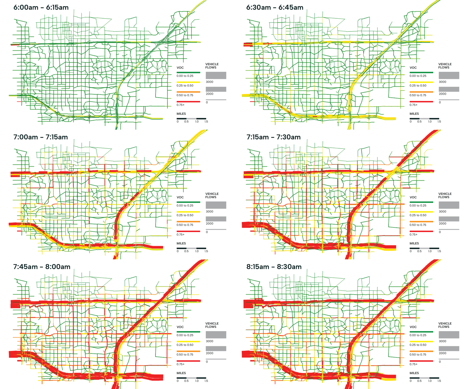
- DTAs can model incremental changes over smaller time periods. This provides a more granular reflection of how traffic conditions might change during an emergency evacuation scenario.
Understanding How Courts Are Shaping Planning
Expectations for evacuation planning and environmental assessments have evolved in California in just the past decade. Beyond California, the latest legislation, guidance, and court rulings can serve as an example of what other states could do to better plan and prepare for wildfire (and other local hazard) evacuations.
Since 2018, the California Environmental Quality Act (CEQA) has included additional requirements for local governments and public agencies to evaluate wildfire evacuation impacts for projects and proposed developments located within fire-prone areas. In addition, since 2019, new legislation including California Assembly Bill (AB) 747, AB 1409, and Senate Bill (SB) 99 have added evacuation planning requirements for local jurisdictions.
While both Safety Element evacuation studies and CEQA evacuation assessments are crucial for ensuring public safety during emergencies, they address different legislative requirements, state guidance, and court decisions. This post focuses specifically on CEQA evacuation assessments and what they mean for public agencies.
Recent court cases have shown that many public agencies are falling short of these CEQA requirements. This has led to legal challenges, project delays, and increased public scrutiny often centered on whether agencies adequately analyzed evacuation routes and public safety during emergencies.
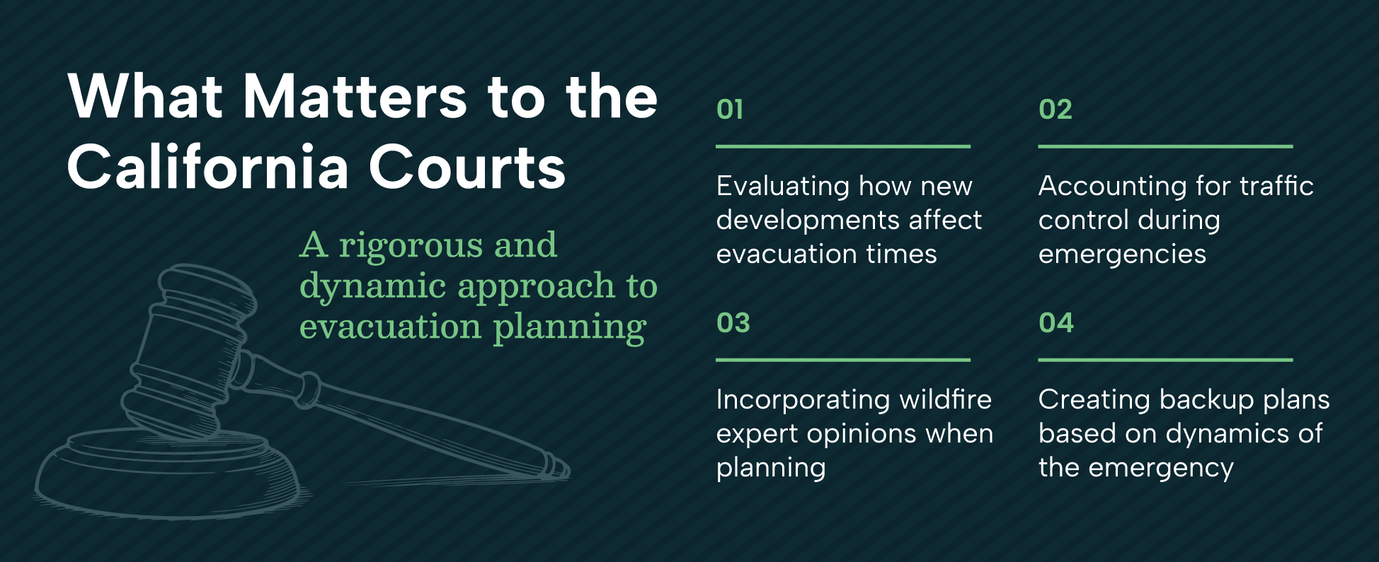
According to the AG’s office, evacuation modeling and analysis should evaluate:
- How the addition of new developments affects the evacuation of project residents.
- The capacity of roads to accommodate evacuations while also allowing access for emergency responders.
- The timing for community evacuation during emergencies.
- Alternative plans for evacuations depending upon the location and dynamics of the emergency.
- How new projects will impact existing evacuation plans and the existing population.
- Local traffic to quantify travel times under various likely scenarios.
The Attorney General’s guidance also urges public agencies to assess and mitigate a project’s evacuation impacts based on the potential need for large-scale evacuations, rather than relying primarily on shelter-in-place plans. Public agencies can also work with fire officials and other first responders to align future projects with real-world conditions; this could help identify any gaps in existing evacuation plans.
Neglecting these steps could substantially understate added evacuation times and the need for evacuation measures, possibly putting project approval at risk and resulting in litigation.
For example, the California First District Court of Appeal upheld rulings in 2022 and 2024 that Lake County failed to adequately analyze wildfire evacuation routes and wildfire risk when certifying a 2020 EIR for a major development, violating state law. Lake County recently released a Final Partially Recirculated EIR that includes substantial new analysis to address the court rulings for these two topics. Other rulings in Placer, Sonoma, and Contra Costa counties indicate that this may be a statewide issue.
Recent Court Rulings
EIRs must assess evacuation impacts.
Appellate court upheld the ruling that the EIR was inadequate for not analyzing how new traffic from a proposed development could worsen evacuation times for existing residents.
Center for Biological Diversity v. County of Lake (“Guenoc Valley Case”), 2024
Evacuation studies must include expert input & transparency.
Key outcomes of this court ruling noted that evacuation studies must be based on wildfire expert opinions, must consider future developments, and must document all study assumptions and parameters for public review and comment.
Sonoma Community Advocates for a Livable Environment (SCALE) v. County of Sonoma, 2024
Evacuation timing must use realistic traffic assumptions.
Appellate court found the project’s evacuation analysis underestimated evacuation times due to a misunderstanding of how traffic control would occur during emergencies.
Sierra Watch v. County of Placer, 2021
The US will continue to experience wildfires—that’s the one constant in all of this. If these recent court rulings in California are any indicator, planners, emergency management officials, and public agencies across the state and in other wildfire-prone areas of the country will change the way they think about wildfire evacuation planning and simulation.
Better simulation models can potentially save lives while also providing legal protection for local governments.
Adopting Dynamic, Data-Driven Models
Public agencies, planners, and transportation consultants have long recognized the shortcomings of traditional models and methods. The message from the court rulings is clear: traditional and static travel model assignments no longer suffice for local evacuation planning.
So, what does the future look like, and how do we move toward it?
Dynamic Traffic Assignment modeling plays a big part. Many public agencies are now adopting DTA modeling to better reflect realistic travel behaviors.
Unlike static assignment models, which assume steady traffic flow and average conditions over an hour time period, DTA models simulate how traffic conditions evolve in real time as drivers respond to delays, detours, or congestion.

DTA models better reflect real-world conditions, which is critical in fire-prone areas where the road network is already stressed and every minute counts.
Dig Deeper
Using DTA for forecasting trip demand for evacuations
Helping You Navigate Evolving Evacuation Standards
Evacuation analysis expectations are evolving.
As California raises the bar with court rulings and evolving requirements, public agencies are expected to adopt more rigorous, transparent, and defensible methods for wildfire evacuation planning.
“Local governments have a responsibility to address wildfire risks associated with new development projects early in the planning process when changes to these projects can still be made.” –California Attorney General Rob Bonta
We are already applying these legal considerations for our clients’ evacuation assessment projects.
By modeling traffic in shorter increments and across more detailed networks, we can produce insights that are not only more accurate and useful, but may also be more defensible in the eyes of regulators, stakeholders, and the courts.
Our DTA models incorporate critical details about the local community, including travel choices, household vehicle ownership, and future changes to the transportation network. By aligning with established regional planning models and calibrating for real-world conditions, we can offer more granular evacuation insights that go beyond traditional and static travel models.
Our experts have a deep understanding and hands-on experience with some of the most complex evacuation studies. Most recently, we applied the above analysis methods in the following projects:
- Sonoma County Safety Element Update (Described by the Board of Forestry and Fire Protection as an example for other jurisdictions [4:05:30])
- Kenwood Winery EIR in Sonoma County for CEQA clearance
- Koi Nation Shiloh Casino EIS in Sonoma County for NEPA clearance
- Montecito Evacuation Study in Santa Barbara County
Many of our analyses have undergone CEQA reviews, and to date, none of our clients have faced legal challenges when using these models. However, we cannot make a guarantee to any of our clients that our analyses using these methods will be immune to legal challenges.
If you’d like help reviewing your current policies to make sure they meet legal expectations, please contact our team. We’re here to help.
share this article
Contributors
Explore More
What Seattle’s Travel Trends Reveal About Post-Pandemic Mobility
The 2023 Puget Sound travel study revealed notable changes in how people get around. Our team identified emerging trends that may hold lessons for other regions.
The Ws of Safety: Treating the System, Not the Symptom
Our safety experts propose a Ws framework (who, what, when, where, and why) to strengthen the Safe System Approach and achieve Vision Zero 2.0.
FP Induced Vehicle Travel Analysis Technical Guidance
This guidance aids agencies in complying with California’s SB 743 by offering tools to quantify VMT impacts and evaluate mitigation strategies.


