
VMTIndex Now Reaches Communities Nationwide

We’re excited to announce that VMTIndex is now available in many of the cities and counties we serve across the US, expanding access to our vehicle miles traveled (VMT) analysis tool beyond California.
Formerly known as VMT+, VMTIndex provides real-world travel data at the Census Block Group level. This web-based dashboard gives transportation professionals local insights to better analyze travel patterns and assess VMT impacts. Newer datasets are also available through our consulting services.
Try VMTIndex for Yourself
Experience VMTIndex firsthand. Visit the Find Your VMT page to explore the tool and see how it can support your projects.
Have questions or need help assessing VMT impacts in your area? Contact our team to learn more.
share this article
Explore More
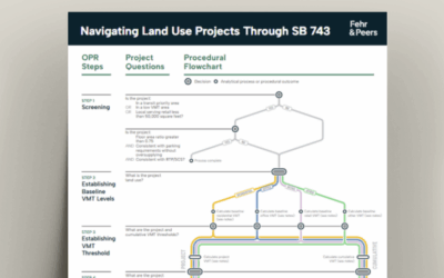
Navigating Land Use Projects Through SB 743
This document offers a step-by-step framework for evaluating and mitigating VMT impacts of land use projects under California’s SB 743 guidelines.

Fehr & Peers Tacoma Opens its Doors
Our new Tacoma office will allow us to continue to grow, better serving our existing and new clients, and giving our staff the opportunity to call the South Sound home.
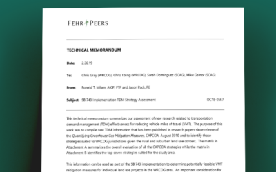
TDM Strategies Technical Memorandum
This information can be used as part of the SB 743 implementation to determine potentially feasible VMT mitigation measures for individual land use projects in the WRCOG area.