
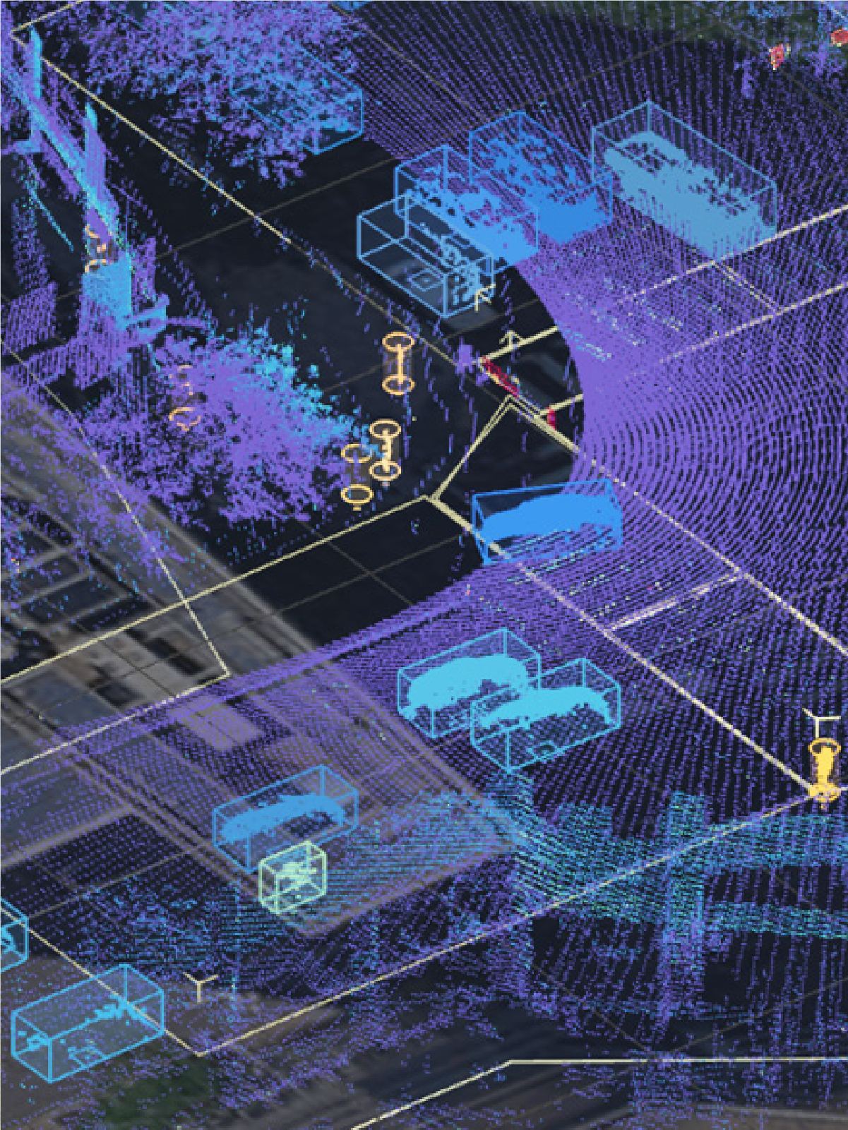
AI is reshaping nearly every aspect of transportation planning and engineering, but perhaps none more so than transportation safety. This segment of the industry is particularly well-suited for AI applications: large datasets, geographically complex relationships, video and sensor data providing real-time information.
AI can supercharge the analysis of some types of safety data and provide insight that was previously difficult to extract, but it is not a universal tool to analyze all types of safety data. This blog explores where AI is providing true value and where it is struggling. As will all things AI, interpretation with the “natural” intelligence of transportation professionals is critical.
Where AI is Working Today
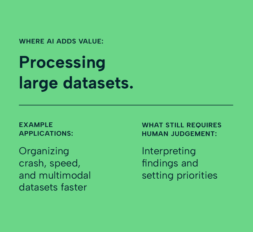
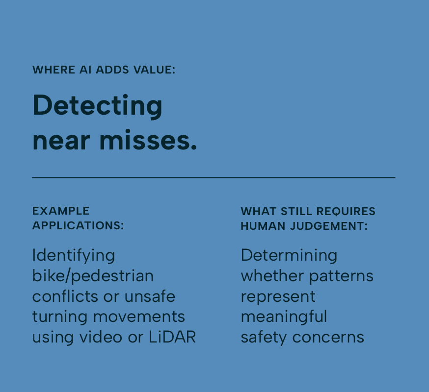
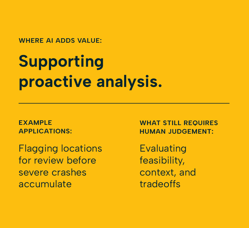
Click through to understand how AI in safety analysis is already proving useful in focused, practical ways:
Where AI is Working Today
Scroll through to understand how AI in safety analysis is already proving useful in focused, practical ways:
What It Looks Like in Practice
Responding to Risk in Real Time
Bellevue, WA | Adaptive Signal Technology
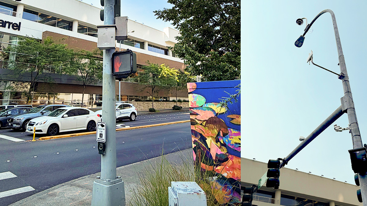
Courtesy of the City of Bellevue.
In Bellevue, Washington, more than half of fatal and serious injury crashes involve vulnerable road users (VRUs), and most occur at signalized intersections, the same ones where signal timing has historically prioritized vehicle movement over pedestrian safety.
While many agencies are still figuring out where AI fits into their safety workflow, the City has already launched an ambitious real-world deployment of AI-supported intersection safety technology. We are watching it closely and think other agencies should too.
Bellevue’s team deployed LiDAR and video sensors paired with edge-computing devices in traffic signal cabinets. The system tracks pedestrians, cyclists, and vehicles in real time and identifies imminent conflicts, such as a slow pedestrian still in the crosswalk or a vehicle about to run a red light. When risk is present, the system can then trigger dynamic safety interventions, including extending the pedestrian walk phase or activating a “No Turn on Red” sign only when it’s actually needed.
Bellevue’s Safer Signals Pilot system can trigger dynamic safety interventions, such as activating the “no-turn-on-red” signal when there are large volumes of people at the crosswalk and cars waiting to turn right. Video courtesy of the City of Bellevue.
VRU-involved near misses dropped by more than 45%. The walk-extension use case reduced near misses by 51%; dynamic “No Turn on Red” operations reduced them by 43%.
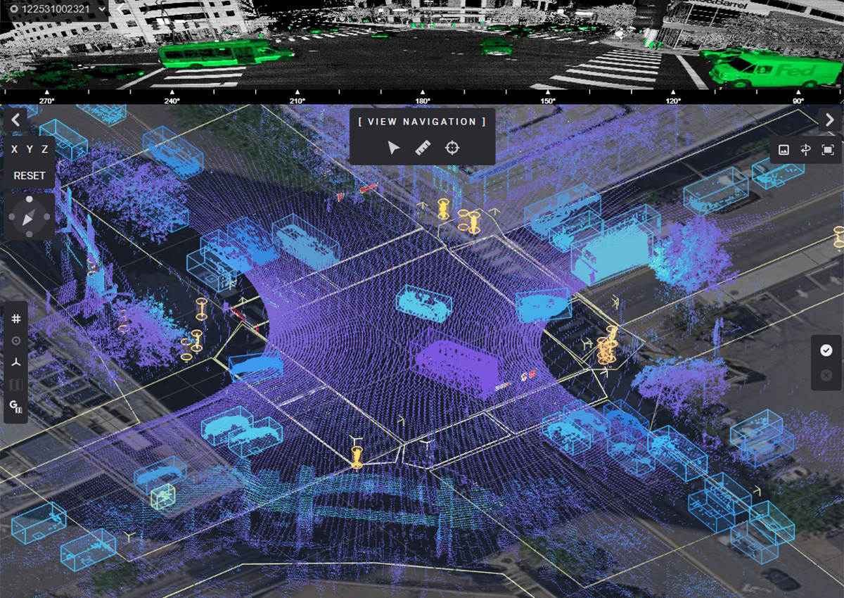
LiDAR system detects vulnerable roadway users, helping reduce potential collisions. Courtesy of the City of Bellevue.
The system was not flawless. Sensors occasionally misidentified shadows, glare, or even vehicle tires as pedestrians. Engineering judgment still determined what qualifies as a slow walking speed, how many pedestrians trigger an intervention, and how to balance safety improvements against intersection capacity and vehicle delay. But even with those constraints, the shift was real and the results show it.
See more at bellevuewa.gov/safer-signals, including animations that show how the interventions work in practice.
Reducing Split-Second Intersection Conflicts
San Bernardino, CA | Dilemma Zone Upgrades (“Red Protect”)
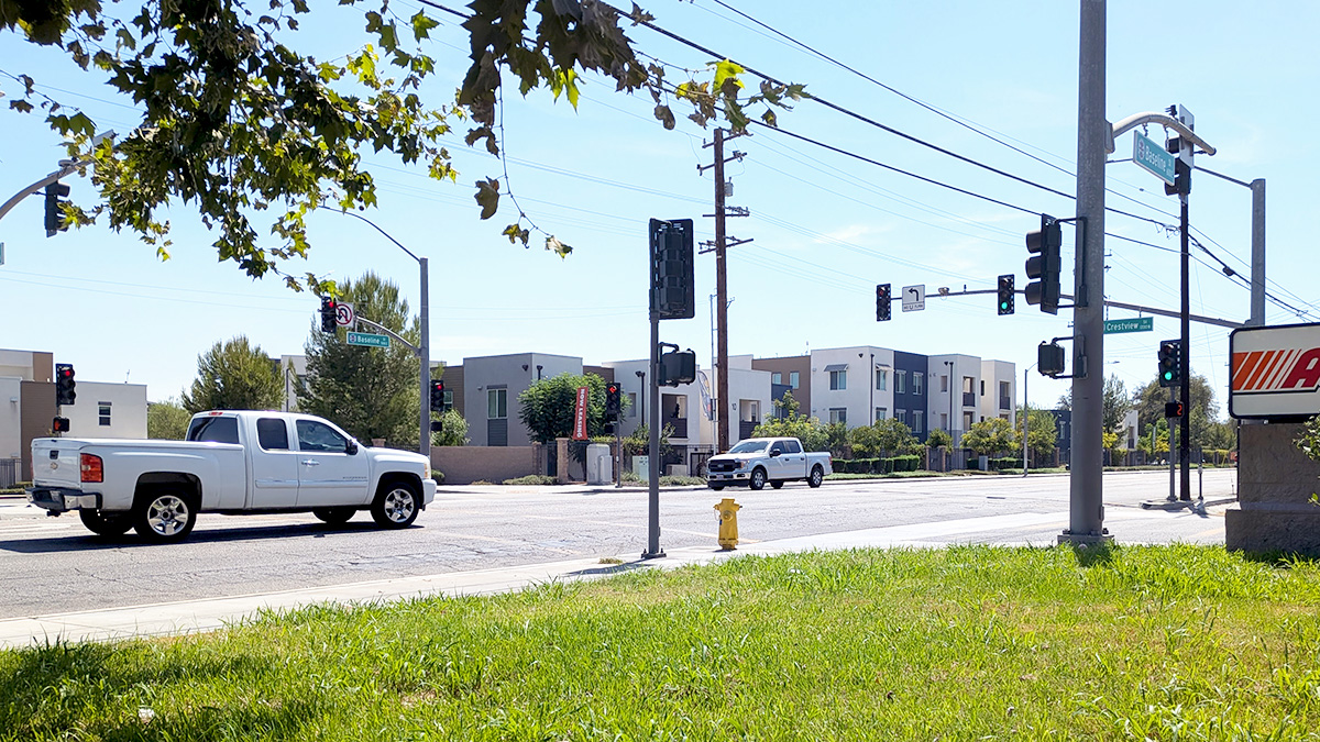
Courtesy of the City of San Bernardino.
Systemic safety analysis pointed to two types of recurring patterns along three of the City’s highest-risk corridors (Highland Avenue, Baseline Street, and Mount Vernon Avenue): rear-end crashes from sudden braking during yellow lights, and right-angle crashes from drivers entering the intersection too late. Both were linked to the same underlying issue.
In Spring 2024, the City installed dilemma zone upgrades at 49 intersections using Red Protect feature utilizing 2070 LX signal controllers and a hybrid camera-and-radar detection system that responds to approaching vehicles in real time. When the system identifies a vehicle in a position where stopping abruptly may be unsafe, it creates a brief protective interval, temporarily holding conflicting movements on red, so the driver can clear the intersection before another movement enters. It isn’t simply extending a green light. It’s the signal system recognizing uncertainty in real time and building in a buffer before that uncertainty becomes a crash.
The results were significant:
Total crashes decreased by 50%.
Fatal and severe injury crashes decreased by 80%.
Right-angle and rear-end crashes decreased by 45%.
Across the treated intersections, the City estimated a reduction of 11.5 fatal and severe injury crashes per year and 98 fewer total crashes annually.
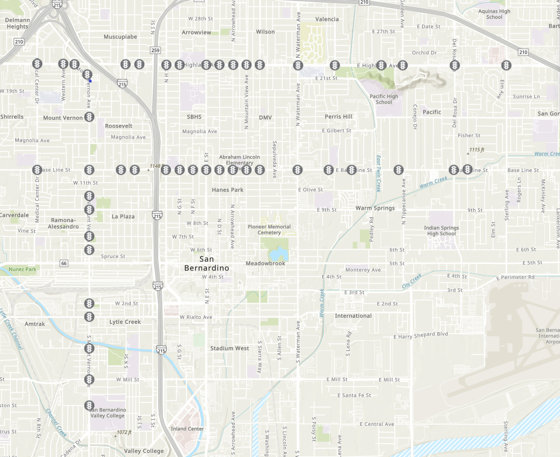
Map showing the 49 intersections with dilemma zone upgrades. Courtesy of the City of San Bernardino.
As with any AI-supported system, engineering judgment remained essential, including determining where the treatment was appropriate, how detection should be calibrated, and how to weigh safety gains against corridor operations and traffic flow. The technology can accelerate the response, but it doesn’t replace the professional oversight that makes it work.
The City also published a StoryMap documenting the before-and-after analysis in more detail.
Where AI Still Struggles in Safety Analysis
AI can support safety analysis in meaningful ways. But the same qualities that make it useful (speed, scale, pattern recognition) can also create a specific kind of risk that is easy to miss.
Crash records may contain inconsistent reporting, underreporting, vague narratives, inaccurate location information, or missing context. That has always been true. What is different with AI is that those gaps do not always show up in the output. A human analyst working through incomplete data tends to flag the gaps and inconsistencies. Unless specifically and systematically prompted, AI does not; and even when prompted, it can be difficult to verify issues.
Ultimately, AI can process a flawed dataset and return results that look clean, statistically confident, and ready to act on. AI can do this work all while quietly missing the corridor everyone in the room knows is dangerous, or underrepresenting a neighborhood where crashes go underreported. The analysis looks rigorous. The blind spots are invisible.
For agencies, that is where the real risk lives. Investments get prioritized, designs get advanced, and communities get, or don’t get, safety improvements based on findings that felt more certain than they were. In this type of analysis, human review is not a procedural step or simply an AI spot check. Human analysis of these types of complex data remains the fundamental standard to ensure accuracy and to honestly serve the public good.
The Future of Safety Analysis is Faster, but Still Human
The most important shift AI is enabling in safety work is not faster analysis. It is the chance to move from reactive—waiting for crashes to accumulate before acting—to proactive, identifying and mitigating risk before it shows up in a police report.
That shift matters. It means agencies can act on conflicts, near misses, and emerging patterns instead of waiting for someone to get hurt. Bellevue and San Bernardino are early examples of what that looks like in practice. Not AI replacing engineering judgment, but AI enhancing that judgment with something faster and richer to work with.
The shift only delivers if the human side of the work gets stronger alongside it. AI is freeing up time to focus on the harder questions: what the data actually means, whether an improvement is feasible, what communities need, and where to invest first.
The agencies getting the most out of AI right now are using it to inform decisions, not make them. That is where the real safety work still lives and where accountability has always been.
Seven questions to ask your team before acting on AI-supported insights.
The questions below are a starting point for reflecting and building that human review into your workflow.
1. What data is being used?
AI is only as reliable as the information it is working from, even when the output looks polished.
2. What data might be missing?
Underreported crash types, certain neighborhoods, or specific user groups can skew results.
3. How were results validated?
A second method, a field check, or a peer review, not just confidence in the model.
4. Do outputs match field conditions?
If the AI’s “high-risk” list does not include the corridor everyone knows is dangerous, something is wrong.
5. Have community priorities been considered?
AI can surface patterns, but it cannot understand lived experience or local priorities on its own.
6. Is the recommendation operationally feasible?
Right-of-way, maintenance, design, and political support all live outside the model.
7. Who remains accountable for the final decision?
Agencies, not algorithms.
Used this way, human review is not a slowdown. It is what turns AI-supported analysis into something agencies can trust and act on.
share this article
Connect with our Contributors

Sean Reseigh
Associate
Fehr & Peers
Email Me

Taylor Whitaker
Associate, RSP1
Fehr & Peers
Email Me

Jessica Shoner
Senior Associate
Fehr & Peers
Email Me

Alma Fargason
Senior Planner
Fehr & Peers
Email Me

Azzam Jabsheh
Deputy Director of Public Works
City of San Bernardino
Daniel Lai
Smart Mobility Manager
City of Bellevue
Franz Loewenherz
Mobility Planning and Solutions Manager
City of Bellevue
Explore More
Looking at Street Safety Through the Lens of Kinetic Energy
This ITE Technical brief explores how kinetic energy can add another dimension to roadway safety analysis, helping practitioners consider where conditions for serious harm may exist even before severe crash patterns emerge.
New NCHRP Toolkit Helps Agencies Build Safety Into Everyday Decisions
Making streets safer takes more than individual projects. Our new Safe System approach toolkit, developed through NCHRP Research Report 1181, helps agencies integrate safety into policies, budgets, design standards, and land use decisions. Explore practical tools, real-world case studies, and new IIHS Safe System success stories that show how agencies are turning safety into standard practice.
Announcing Safety Multipliers
What do San Francisco’s Van Ness BRT, New York’s congestion pricing, and Arlington’s intersection program have in common? Each pulls all three Safe System levers at once. We call that pattern a safety multiplier.