Communities have started to experience an increase in the frequency and severity of emergency evacuations, in part due to the impacts of climate change. As a result, state legislators, including the California Senate and Assembly, have acted by requiring new emergency evacuation analysis in project environmental documents and General Plans. Recent CEQA litigation accompanies state regulations such as SB 99, AB 747, and AB 1409 in underscoring the importance of evacuation analysis.
As experts in climate and resilience within the transportation industry, we offer specialized services to help our clients navigate transportation-related challenges during disruptive events. With a deep understanding of traffic operations and travel demand forecasting, our team uses innovative tools and approaches to help clients address complex emergency evacuation questions. By updating emergency preparedness and communication plans, communities can ensure that residents and visitors are well-informed and equipped to evacuate safely during emergencies.
Evac+ dynamically evaluates evacuation scenarios to provide insights into how many trips are made, where vehicles go, and how long an evacuation trip might take. Interfacing with a regional travel demand model, Evac+ bridges the gap between regional travel models and microscopic traffic simulation models, making it just the right scale for evacuation studies. The tool can help us understand how congestion levels change over time during an evacuation and identify potential problem areas or bottlenecks on a network. Additionally, Evac+ can help identify areas where the development of advanced communication strategies is particularly important.
Resilience+ assesses transportation networks for underlying hazards and appropriate access to city evacuation routes, evacuation centers, and resilience hubs. Resilience+ merges GIS in a workflow that reflects changes in travel routes based on barriers created by natural disasters such as wildfires and flooding. Additionally, it facilitates the development of reliable and accurate communication strategies for emergency needs and evacuations.
TravelAccess+ analyzes and visualizes how much access is provided by each mode of travel to reach destinations of interest within a transportation network. TravelAccess+ considers things such as employment, evacuation areas, medical services, and education, and further incorporates census data to provide a more detailed understanding of how access may vary among different demographic groups and where gaps may exist.
We understand the importance of being ready for anything that comes your way, and we’re committed to supporting our clients and their communities in building their resilience to future emergencies and obstacles. Our primary aim as experts in the field is to ensure that individuals can reach their intended destinations, even in times of crisis. To learn more about applying our tools to your emergency preparedness and communications plans, contact us!
share this article
Contributors
Chelsea Richer
Climate & Resilience Discipline Leader
Email Me
Bob Grandy
San Francisco Market Leader
Email Me
Jason Pack
Orange County Market Leader
Email Me
Explore More
Turning Data into Transit Currency
See how three U.S. cities are using data-driven storytelling to connect transit to daily life, reshaping it into something people want to ride and invest in.
Olympic-Size Mobility
Olympic fever fills the air as Paris hosts the 2024 Games, welcoming millions of visitors. Meanwhile, Los Angeles gears up for the 2028 Olympics, focusing on improvements that will benefit the city long after the games end.
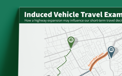
Induced Vehicle Travel Example
Here’s an example of how highway expansions influence our short-term travel decisions


