
Safer Roads, Smoother Evacuations
Safer Roads, Smoother Evacuations
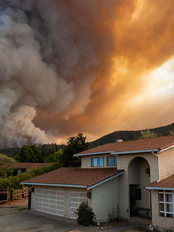
Systemic safety and emergency evacuations: how can we ensure neither is compromised in our planning? While safety measures often aim to slow down cars to benefit pedestrians and cyclists, evacuations require speeding up these same roads for the swift exit of vehicles during emergencies.
The wrestle among these imperatives has been building and converging on the desks of transportation planners. A refocus has emerged among policies and funding for initiatives like Vision Zero and Safe System, which aim to prevent roadway deaths and serious injuries. Meanwhile, new legislation and CEQA lawsuits are pressuring agencies in high wildfire zones to prioritize evacuation planning. Measures such as widening roads, for example, may help evacuations but can increase crash exposure and severity, while safety measures like calming traffic and reducing travel lanes could hinder rapid evacuations. Commonly, safety enhancements are proposed on high-injury corridors, especially to improve day-to-day access and comfort for vulnerable road users. However, many of these corridors are also designated as evacuation routes, with enhancements proposed for speed and throughput for cars in an emergency. Bottom line: agencies must now consider both safety and evacuation needs simultaneously.
Integrated Planning for Safety and Evacuation
Integrating evacuation and safety goals from the start of street redesigns or land use plans spurs collaboration and win-win strategies. When supporting clients in these upstream discussions, we leverage a cross-disciplinary approach partnering our in-house national experts in safety, evacuation, resilience, and CEQA/NEPA to analyze these goals upfront and together. Along with insights from the national and local policy we help shape, this allows us to walk agencies through challenging questions about the give-and-take of tradeoffs among their objectives, as well as how to set and use thresholds for environmental impacts and mitigation. Through this upfront practice leader collaboration, we can develop innovative combinations of existing and emerging strategies to comply with safety and evacuation policies and ensure evacuation planning upholds safety goals and vice versa.
Enhancing Safety and Evacuation Agility through TSMO
Many existing roadways were designed for vehicle throughput which neglects pedestrians and cyclists. The nationwide Safe System Approach advocates for reallocating right-of-way, particularly on arterials, to better accommodate all users. Drawing on the tools and strategies of Transportation Systems Management and Operations (TSMO), a better balance is possible. TSMO strategies can align evacuation needs with Safe System and Vision Zero goals. This involves integrated planning across multiple agencies and departments, establishing communication lines, and identifying shared responsibilities to maximize the performance of existing plans and infrastructure. By focusing on improvements that can maintain and restore the performance of the existing transportation system, agencies can stretch their funding and get the most performance out of the transportation facilities they already have.
For example, a street conversion project on an evacuation route and high-injury corridor can be designed to promote walking and biking while addressing systemic safety risks and ensuring it remains useful during an evacuation. In a recent NEPA evacuation assessment effort in Sonoma County, CA, we balanced evacuation needs with road safety without overbuilding the roadway system in the community. This included installing variable message signs at project driveways and key intersections, as well as implementing signal timing plans for wildfire events that would maximize green times on key evacuation approaches.
A Win-Win Idea
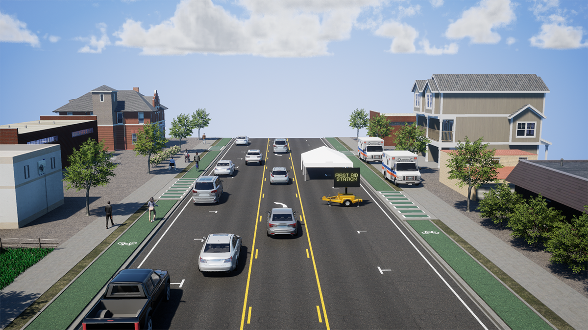
The figures below go through the shift from a conventional roadway design to a flexible alternative for use during an evacuation that also enhances comfort and access for multi-modal users on a daily basis.
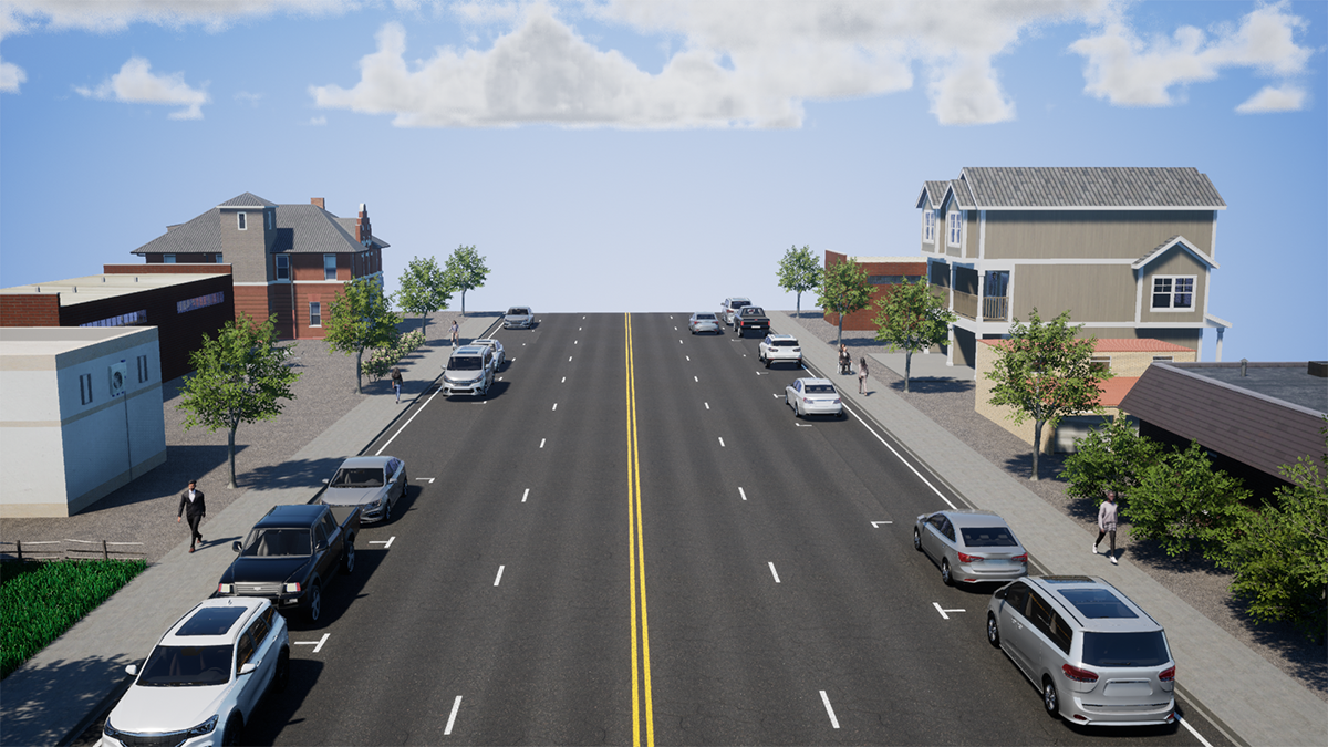
Four Lane Road with On-Street Parking: Roadways have historically been designed for vehicle throughput. This includes wide, 12-foot lanes and on-street parking, with narrow sidewalks and limited design for bicycle facilities.
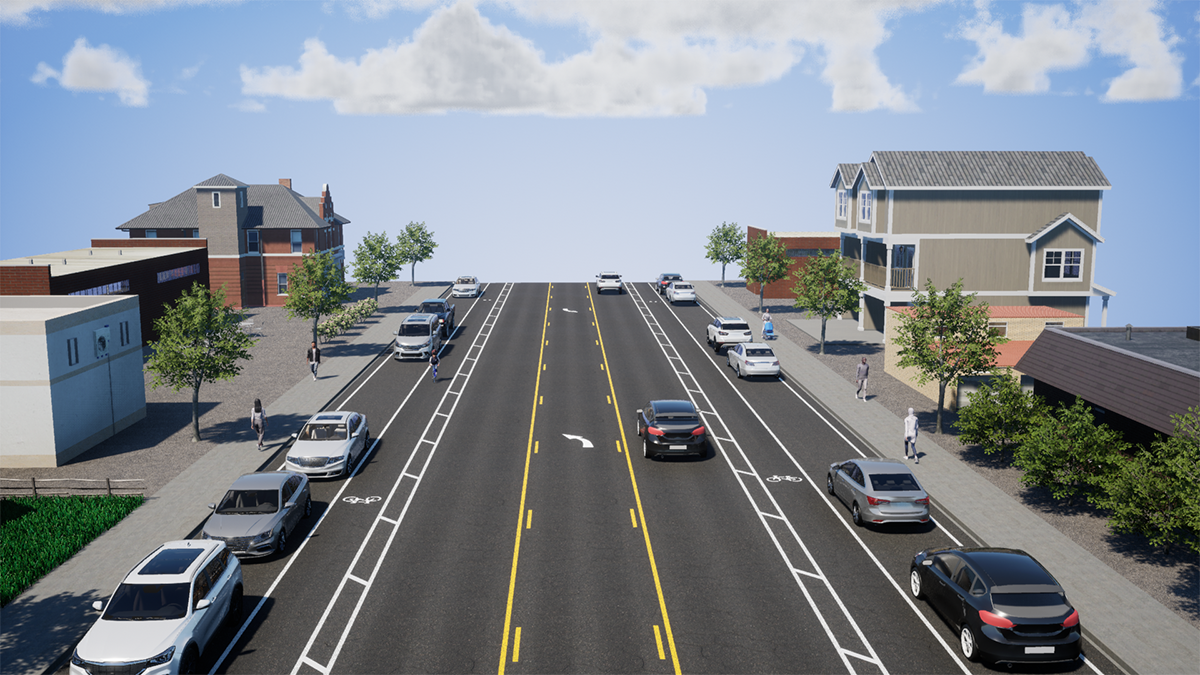
Road Diet with Buffered Bike Lanes and On-Street Parking: As complete streets design became standard practice, jurisdictions started redesigning roadways following a “classic” road diet formula: four to three travel lanes, bicycle facilities, and a two-way left turn (TWLT) lane. This allowed for traffic calming measures along a corridor and an on-street facility for bicyclists.
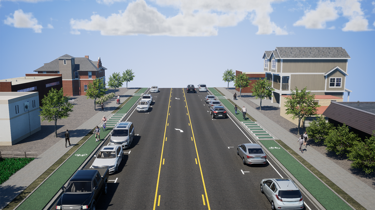
Road Diet with TWLT, On-Street Parking, and Separated Bikeways: This “win-win” reconfiguration using flexible roadway design separates users in time and space and gives jurisdictions the flexibility to accommodate everyday traffic as well as additional vehicle throughput during an emergency evacuation event. This would require special attention to lane widths and materials to ensure emergency vehicles can use the multimodal space.
Summary
Early and integrated planning for safety, complete streets, and evacuation needs can prevent potentially conflicting plans for roadway right-of-way. Re-envisioning roadway space with TSMO strategies can address day-to-day safety concerns while maintaining usable space during emergency conditions and even optimizing the performance of existing transportation systems for all users. For more examples and strategies, contact us or check out our white paper here.
share this article
Contributors

Ashlee Takushi
Senior Transportation Planner
RSP1
Email Me

Grace Chen
Transportation Engineer/Planner
Email Me

Chelsea Richer
Principal
AICP
Email Me

Ian Barnes
Principal
PE
Email Me


Explore More
Intern Perspectives: A Summer in Transportation
What does a transportation internship actually look like? This summer, 25 interns across 14 of our offices gained hands-on experience with fieldwork, street design, GIS, data analysis, visual communication, client work, and community engagement. See what they learned, what surprised them, and how the experience shaped the way they think about careers in transportation.
Looking at Street Safety Through the Lens of Kinetic Energy
This ITE Technical brief explores how kinetic energy can add another dimension to roadway safety analysis, helping practitioners consider where conditions for serious harm may exist even before severe crash patterns emerge.

Understanding AI’s Role in Transportation Safety
AI is giving transportation safety practitioners new ways to analyze data, detect near misses, and respond to risk before crashes happen. Real-world examples from Bellevue, WA and San Bernardino, CA show where AI-supported technology is delivering value—and where human judgment remains essential for turning data into responsible safety decisions.