
Fast-Tracking Multimodal Analysis

Fast-Tracking Multimodal Analysis
Designing them in a fraction of the time is.
Test Your Street Design in Real-Time.
From vehicle spaces to people spaces, practitioners often find themselves on spreadsheet rabbit trails or toggling between apps to access the important values and comparisons they need. The SEMCOG/MDOT Multimodal Tool is a first-of-its-kind web application that streamlines the design and evaluation of complete streets with maximum efficiency. Incorporating a built-in lens for safety and equity, it provides agencies a solid technical basis to justify the design or reconfiguration of streets by accommodating all modes on their appropriate networks.
Powered by multiple datasets and a simple interface, beginners and experts alike can:
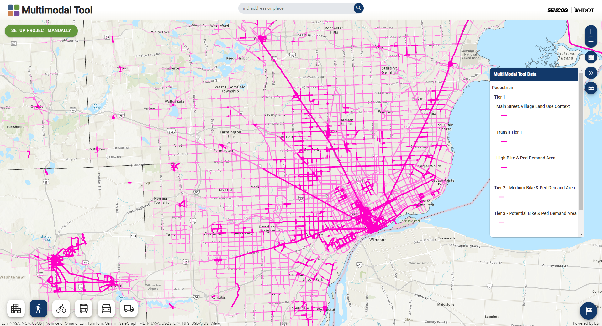
View Modal Networks
Look at different modal networks across the Southeast Michigan region, land use contexts, and select specific project corridors.
Courtesy: SEMCOG/MDOT
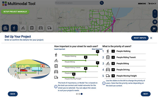
Apply a Manual Option
Outside of Southeast Michigan, plug in street values and prioritize road users. Versatile enough for use on any street in the US or worldwide.
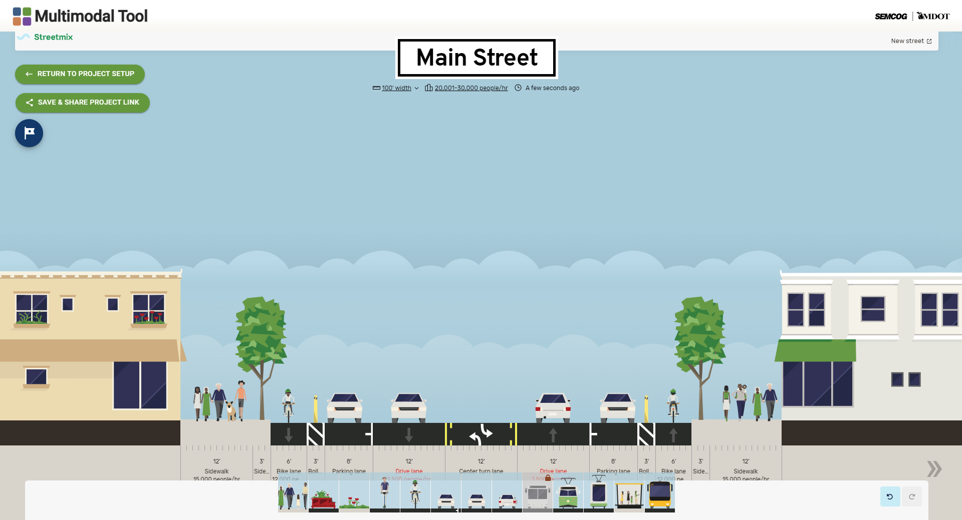
Test Street Designs
Design and modify street cross-sections for any geography using Streetmix and a control panel of options.
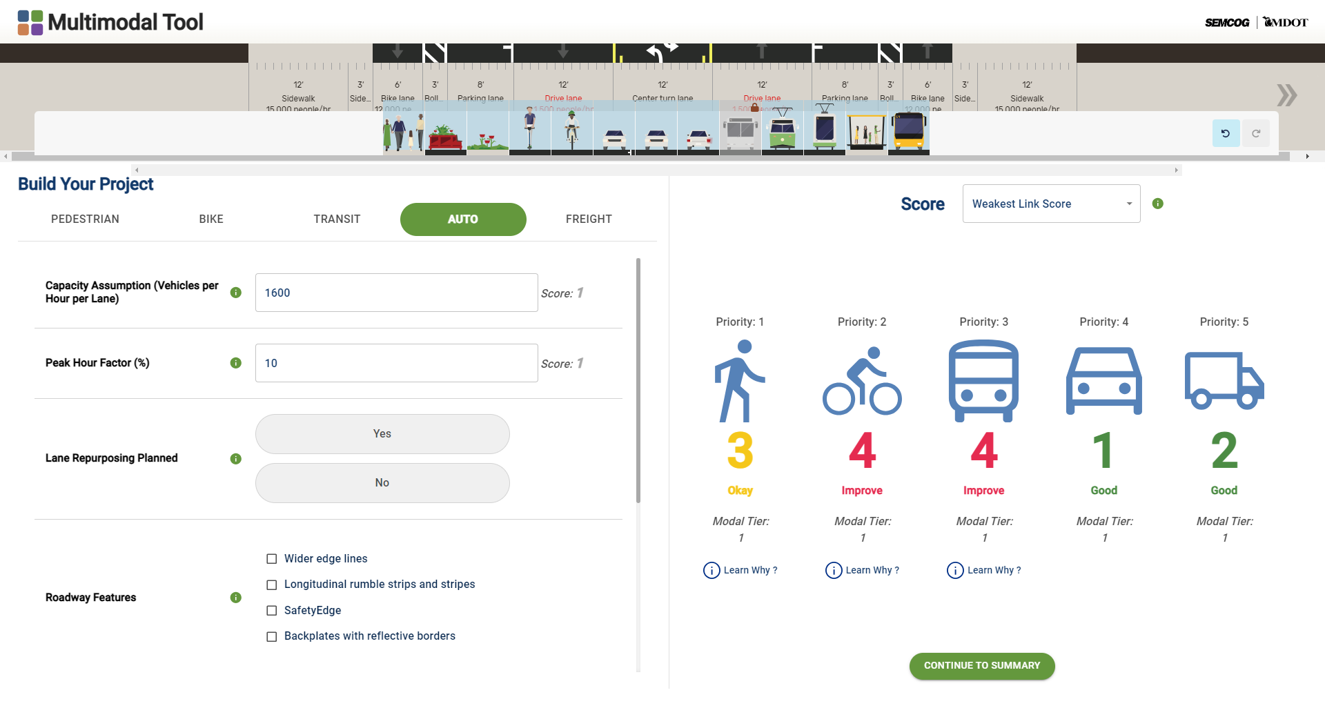
View Design Scores
Understand how well street designs serve users through dynamic and real-time scoring.
Their Keen Idea. Our Power Driving It.
Our long-standing partnership with the Southeast Michigan Council of Governments (SEMCOG) and the Michigan Department of Transportation (MDOT) to improve street safety and livability led us to develop this groundbreaking tool. From SEMCOG’s vision, we crafted the structure to bring this effort to life. Along with Blue Raster, who helped develop the tool’s user-friendly interface, and the boots-on-the-ground expertise of C2G, we included a multi-disciplinary team from our national bench of experts. Applying our in-house tool, StreetScore+, we created an application that can plan, test, and evaluate designs and a variety of performance measures at once. Key utilizations include:
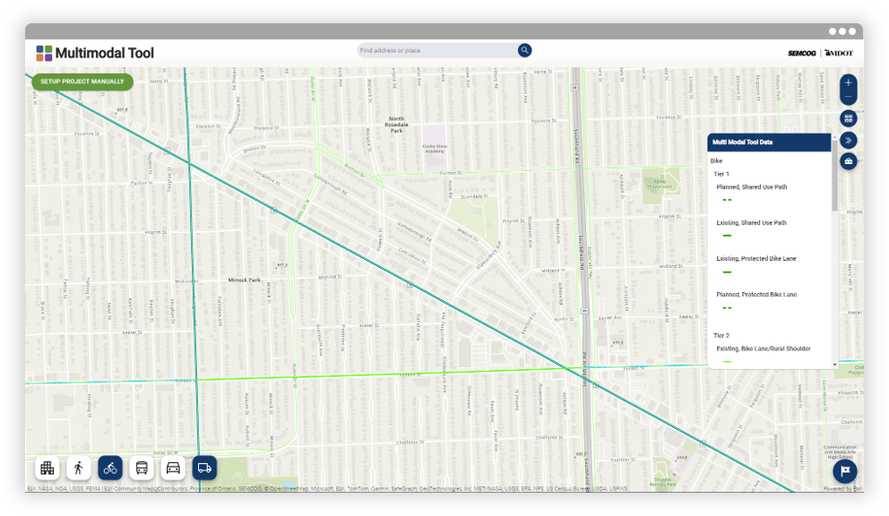
Corridor Planning
The tool is great for seeing how modal networks and land use contexts overlap.
Courtesy: SEMCOG/MDOT
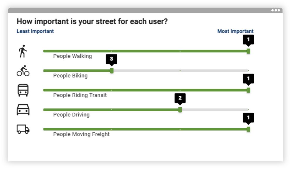
Engagement
The easy-to-use interface breaks down barriers to meaningful engagement.
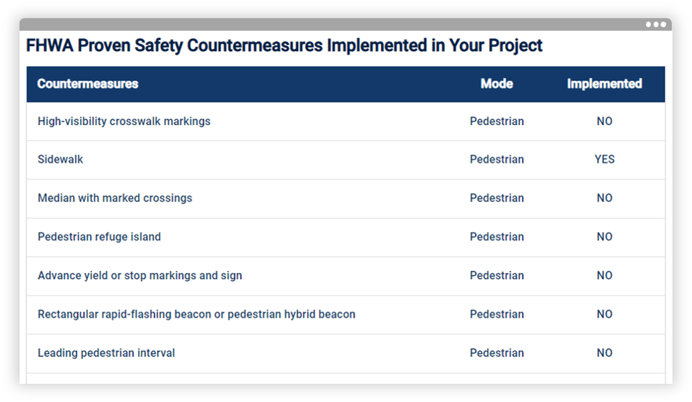
Grant Applications
The tool itemizes FHWA Proven Safety Countermeasures implemented in your project.

Project Evaluation
The tool’s built-in scoring makes it easy to understand performance and tradeoffs.
The Tool in Action.
In Michigan’s Detroit-area, MDOT used the SEMCOG/MDOT Multimodal Tool to evaluate nine conceptual alternatives for the Gratiot Avenue Planning and Environmental Linkages Study. Metrics from the tool quickly revealed how well each alternative served the various travel modes, immediately highlighting which options fell short of the project’s goals. By efficiently narrowing the list from nine to three options, the team saved significant amounts of time and was able to concentrate its limited analytical resources on the most promising complete streets alternatives for Gratiot Avenue.
“The SEMCOG/MDOT Multimodal Tool translates planning guidebooks into real-world applications. It provides a framework for determining project priorities with stakeholders and evaluating street designs with multimodal performance measures. Proven valuable in corridor planning and community engagement in Southeast Michigan, it will also support grant applications and project evaluations.”
Jenya Abramovich, Planner, SEMCOG
share this article
Contributors

Cullen McCormick
Email Me

Matthew Ridgway
Email Me

Alex Bourgeau

Brad Strader
C2G Director of Planning

Jenya Abramovich
SEMCOG Transportation Planner
Explore More
Intern Perspectives: A Summer in Transportation
What does a transportation internship actually look like? This summer, 25 interns across 14 of our offices gained hands-on experience with fieldwork, street design, GIS, data analysis, visual communication, client work, and community engagement. See what they learned, what surprised them, and how the experience shaped the way they think about careers in transportation.

Looking at Street Safety Through the Lens of Kinetic Energy
This ITE Technical brief explores how kinetic energy can add another dimension to roadway safety analysis, helping practitioners consider where conditions for serious harm may exist even before severe crash patterns emerge.

Understanding AI’s Role in Transportation Safety
AI is giving transportation safety practitioners new ways to analyze data, detect near misses, and respond to risk before crashes happen. Real-world examples from Bellevue, WA and San Bernardino, CA show where AI-supported technology is delivering value—and where human judgment remains essential for turning data into responsible safety decisions.